Examples Using the Route Manager
All of these Plugins and more are included in our Yearly Membership plan
- Created: January 21, 2016 5:16 pm
- Updated: March 7, 2023 10:21 am
Categories:
Route type: Walking
Difficulty grade: 4) Very Hard
- Distance 54 km
- Duration 13 h 33 min
- AVG speed 4.0 km/h
- Min altitude -118 m
- Peak 882 m
- Climb 2123 m
- Descent 2243 m
- Distance Instructions
Label
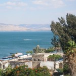
This route cross the upper part of the Galilee. Starts at the mediterranean sea until it reaches the sea of Galilee
Image: "Sea of Galilee 2008" by Pacman - Self-photographed. Licensed under Public Domain via Commons - https://commons.wikimedia.org/wiki/File:Sea_of_Galilee_2008.JPG#/media/File:Sea_of_Galilee_2008.JPG
This route cross the upper part of the Galilee. Starts at the mediterranean sea until it reaches the sea of Galilee
Image: “Sea of Galilee 2008” by Pacman – Self-photographed. Licensed under Public Domain via Commons – https://commons.wikimedia.org/wiki/File:Sea_of_Galilee_2008.JPG#/media/File:Sea_of_Galilee_2008.JPG


